Welcome to CatchIS

Datasets overview
CatchIS data resources
CatchIS draws upon a wide range of data resources in it's operations. The available datasets provided currently include:
- Source Protection Zones (Env Agency)
- Local Authority Boundaries
- District Health Authority Boundaries
- 1:250,000 topographical backdrop raster data
- Enhanced 1:50,000 topographical backdrop raster data
- Water Quality Zone Boundaries
Key Spatial Datasets
Data provision in CatchIS
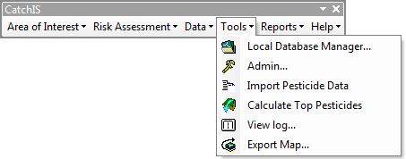
Thematic datasets are accessed via the ‘Data’ menu.
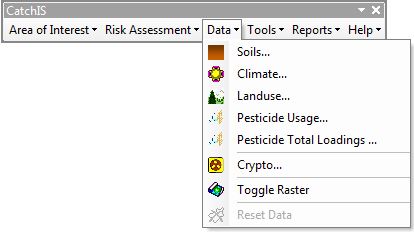
The data layers are useful for presentational purposes and for interrogating model results:
Soil data (soil association, soil runoff potential, soil leaching potential)
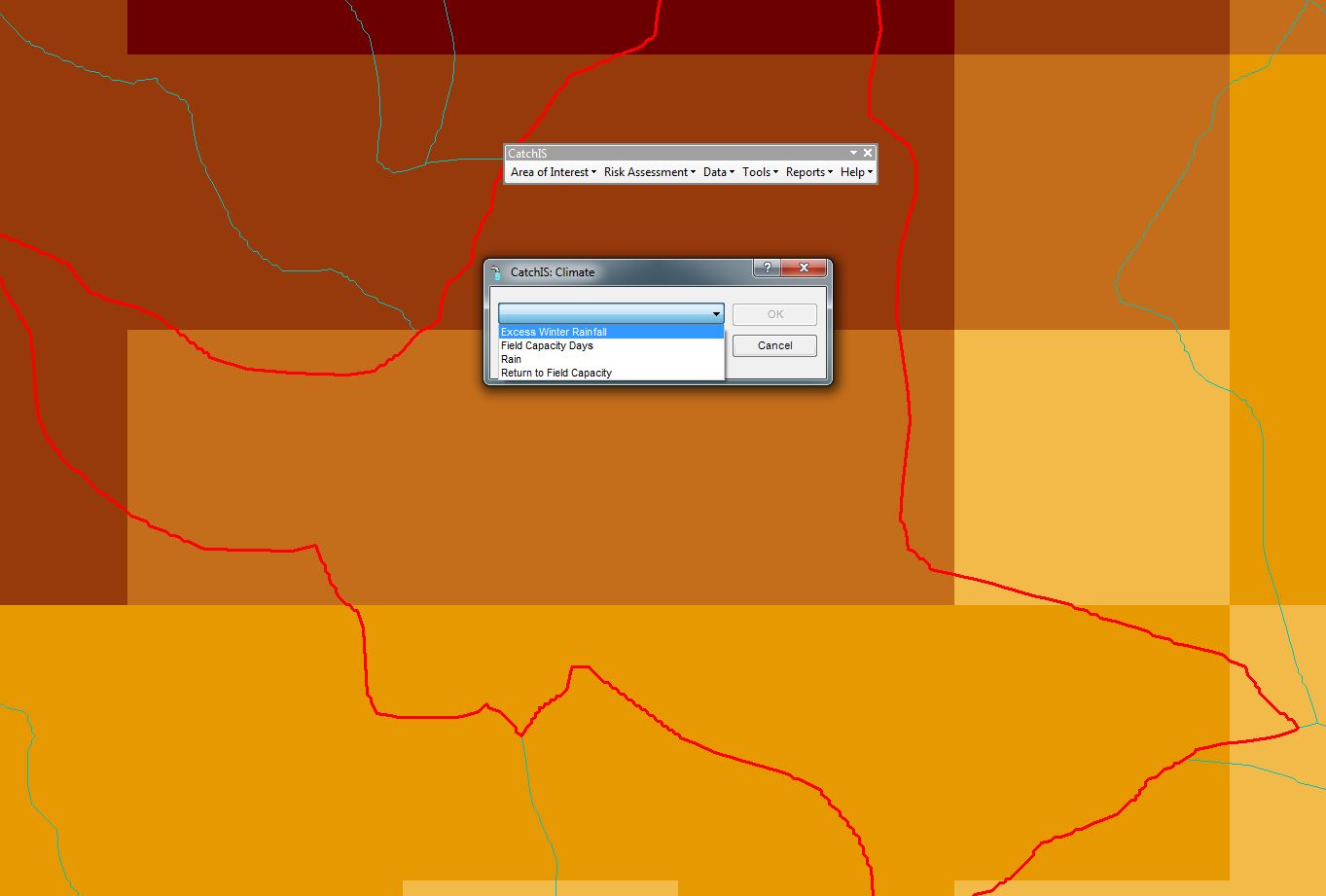
Agro-Climatic data (field capacity days - fcd, excess winter rain - xwr, return to field capacity - rfc)
Landuse data - from ADAS UK Ltd.
Topological Raster backdrop data - 250k / 50k and toggle for switching on and off on display. In fact any raster backdrop can be used - but we often use the OS Landranger datasets.
Soils datasets from LandIS
Digital soils information from NSRI
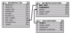
The Cranfield Centre for Environmental & Agricultural Informatics (CEAI) incorporates the former National Soil Resources Institute (NSRI), and Soil Survey and Land Research Centre (SSLRC) and, as a result, maintains all the published and unpublished paper soil reports and maps for England and Wales. CSAI market and lease a wide body of digital soil information, comprising the following principal data sets:
- Vector and gridded vector versions of the 1:250,000 scale National Soil Map (NATMAP) including the simplified Soilscapes version;
- The National Soil Inventory of data on soils and topsoil chemistry;
- Representative values or a range of properties and derived functional values for soil series;
- Soil profile descriptions, a proportion of which have accompanying analytical data.
All these data sets are held in the Cranfield's Land Information System, or LandIS. This is a relational database that is maintained by CSAI staff.
TopAgroclimatic datasets from LandIS
Digital climatic information from NSRI
CatchIS draws on a series of derived gridded agro-climatic variables for England and Wales (Jones and Thomasson, 1985). These datasets are held in Cranfield's Land Information System, or LandIS. These data were generated using long term historical datasets to characterise agroclimatic parameters. Parameters used in CatchIS include the climatic assessment of soil wetness (FCD) when excess rainfall is expected to induce runoff, the amount of rainfall during this period (XWR), the annual amount of rainfall available for leaching (AAHER) and the average annual rainfall (AAR).
All these data sets are held in the Cranfield's Land Information System, or LandIS. This is a relational database that is maintained by CSAI staff.
TopPesticide usage data
Improving the predictive capacity of CatchIS
CatchIS is able to utilise a series of unique datasets from ADAS which substantially improve the predictive nature of the risk modelling, using a forecast of pesticide usage and landuse characteristics on a catchment basis over the coming year. This dataset can be updated bi-annually and can have a spatial grid resolution of 1km x 1km on the ground. Examples are presented below to provide an indication of the nature of these datasets.
Top
This information, or critical importance to the catchment manager has been developed using two unique data sources and combined using GIS manipulation:
- ADAS 1Km2 agricultural census data
- Local crop rotations and pesticide usage data from ADAS experts
The 1 Km2 Agricultural Census Data represents a distribution of all crops reported in the census and is developed from Defra's highest resolution data, and supplemented by other datasets (including the CEH Landcover and Ordnance Survey Vector mapping).
Top
ADAS' expertise builds upon this data through the use of local 'field walkers' and agronomists. This provides:
- Pesticide usage statistics by catchment
- Local crop rotations by catchment (to augment the ADAS 1Km2 agricultural census)
- 6 monthly updates to account for inter-annual variation
By combining these data sources together and applying ADAS' unique expertise, CatchIS users benefit from:
- Agricultural Census data modified using local rotations
- Distribution of the catchment scale pesticide usage statistics over the modified 1Km2 census data
- Combination carried out in GIS providing mapped output
 of Chlormequat on Wheat. Copyright © ADAS")